Wednesday, September 25, 2013

Day 48


Welcome! Day 48 (Sept 25) of North to Alaska


Quote: “No matter where you go, there you are.”

Tonight we are in Crescent City, CA. The day started with a so-so breakfast. I let Cassie sleep late again. So we got a late start to what proved to be a long day. We left about 10 and arrived in Crescent City about 7:10. Driving time was about 7 hours but we stopped often as we travelled along the coast of Oregon on Highway 101. While I do like the mountains the view of the waves hitting the shore is a site to behold. As you would imagine, the road was full of curves much like some of the mountain roads but with the added slowdowns of many small towns along the way. Also we encountered much more traffic than on any of our mountain roads.

The drive today was tiring but we did stop often, I think Cassie would have been happy to stop at every pullout. If we did we would still be driving.

I did take a lot of pictures but I will only share a few today.

Crescent City is near the Redwoods so tomorrow before heading south we will tour some of the forest.
Bridge over Columbia River

Waves at first pullout south Astoria

Waves at next pullout

Waves south of Lincoln

Historic Bridge over Yaquina Bay

South of Newport OR
 

Tuesday, September 24, 2013

Day 47


Welcome! Day 47 (Sept 24) of North to Alaska


Quote: “Travel makes one modest. You see what a tiny place you occupy in the world.” – Scott Cameron

We are now in Astoria, OR. The day started again with a great breakfast. First we had melon and strawberries. Then they brought out pancakes with walnuts and bananas, adding warm maple syrup made a delicious breakfast. For some reason I ate it all and I was hungry no longer. We left right after breakfast, I had already packed the rest of our luggage. We had to catch a ferry to Port Townsend at 11 AM which meant we needed to be there at 10:15. Since Cassie wanted to sleep late we started breakfast at 9:30. We arrived at 10:30 but had no problems getting on. We did have a serendipity as we got in line for the ferry. Next to us were 8 classic autos from an Idaho Car Club. I took a few pictures and talked with a couple of the guys. They were just making a loop thru northern Washington, down to Oregon and then back over to Idaho. They seemed to be having a good time, relaxed and enjoying the drive. We boarded the ferry and took the 28 minute ride across the bay. We then headed south on 20 till we got to 8 then over to 101. Then down 101 till we reached Astoria which in at the mouth of the big Columbia River. As we crossed the river we saw at least 6 large barges anchored just off shore of Astoria. The ride down was mostly uneventful as the road was good, paved two lane with a speed limit mostly set at 55 and we had moderate traffic. We did go thru the town of Sheldon, WA. Sheldon is known for Christmas trees and oysters. From Nov 1 thru Dec 15 about 3 million Christmas trees will be shipped from Sheldon.

We had a light supper. I enjoyed the hot tub for a few minutes and now getting ready for bed.

So ended Day 47. Tomorrow on down U. S. 101.


Classic Cars

Classic Cars in Ferry

Bird says leave me alone

Fisherman

Birds fishing
 
Port Townsend

Out our motel window looking south

Looking north


Day 46


Welcome! Day 46 (Sept 23) of North to Alaska


Quote: “Travel teaches toleration.” – Benjamin Disraeli  

Tonight we are still in Coupeville, WA. This was as planned for today was laundry day. So the morning started with a great breakfast of some type of egg casserole. It had a few mushrooms but I ate around them. Cassie of course ate it all. Then I got the rest of our clothes from the car. In addition to washing we needed to repack from our larger suitcases into our smaller ones for the next twelve days. We mostly leave our larger cases in the car each night and only get out the smaller ones for the next day. We pack for 4 days in our smallest ones, 8 days in the next size and everything else in the larger ones hoping we don’t need it for 12 or so days.

Then on to laundry, first we separated our clothes into 5 stacks. (I would simply fill up a washer and move on to the next but Cassie insists we must separate and cannot wash everything together). I separate mine and Cassie does hers. I then loaded the stacks back into the car and headed to the Laundromat. Of course Coupeville does not have a Laundromat so I travelled up the road to the big town of Oak Harbor and found a nice one. I washed and dried all the stacks. How this was accomplished I will never tell. The clothes are clean and dry. This all took about 2 hours. I returned and we folded and repacked our various suitcases. I reloaded the car with all but my electronics and Cassie’s essentials which I loaded the next morning.

While I was busy washing clothes Cassie walked down to Front Street and got some soup and pastries from a bakery. She said walking down was easy but then she had to walk back up. Our B&B is about halfway up a long hill.

For dinner we went back to Front Street and ate at the Front Street Grill. Cassie had some prawns and salad while I stuck with an old fashion cheese burger and fries. Remember I really had no lunch.

So ended Day 46. Tomorrow heading south on US 101. We will see where it leads.   

Sunday, September 22, 2013

Day 45


Welcome! Day 45 (Sept 22) of North to Alaska


Quote: “Kilometers are shorter than miles. Save gas, take your next trip in kilometers.” – George Carlin

Tonight we are in Coupeville, WA. This is located on Whidbey Island. After leaving Osoyoos we traveled south through the border crossing. A nice lady was at the booth who I think was bored and wanted to talk. So I smiled a lot and made good conservation. She opened both rear doors and the tailgate. Of course she could not see anything since we had the back packed almost solid. We talked about Alaska and we talked about Texas finally she let us proceed. We then proceeded south on US 97 instead of BC 97, for about an hour. We passed several Apple Orchards many were being harvested. In Okanogan we stopped and filled the car with gas at 3.80 per gallon. Then turned onto Highway 20 and headed for the Cascade Mountain Range. Just after we turned we started up and began doing switchbacks and I heard Cassie says this going to be a very good road. You may have guessed this part of Highway 20 is a Triple A dotted road. Not only was the road up and down and very curvy it had lots of traffic. I guess most were Sunday afternoon drivers to see the Mountains. On top of all else it rained most of the afternoon. We were not in the clouds and had very little fog so we had some great views.

We did make it here and are staying at the Anchor Inn a B&B on main street Coupeville. This is a very nice place. If breakfast is like everything else it will be a great place. For supper we ate in an historical Tavern on Front Street by the water. The building was built in the late 1800’s. The Tavern has been around since 1938. We were early enough to stay away from the rowdy bunch and the food was good.

So ended the day. Tomorrow we remain here to do laundry and settle on our plan for the next couple of weeks.   
From one of the pullouts on Highway 20

Our B&B

From our window at B&B
 

Saturday, September 21, 2013

Day 44


Welcome! Day 44 (Sept 21) of North to Alaska


Quote: “Thanks to the Interstate Highway System, it is now possible to travel across the country from coast to coast without seeing anything.”  Charles Kuralt, On the Road with Charles Kuralt

Today we arrived in Osoyoos. Scenery wise, I thought today would be much like the last couple of days. Boy was I in for a surprise. We started out around nine heading south. The first part of the drive was as I expected. Good road, rolling hills, light rain and little traffic. All in all a nice day for a leisurely drive. After a couple of hours we turned off of Highway 97 onto Highway 8. We immediately found ourselves in the mountains. Highway 8 was paved but much narrower than 97. It also had some sharp turns that hugged the mountain. We also went up and down a good bit. I stopped at one pull out and took some pictures. Once we hit Highway 5, like an Interstate highway, the curves were not as pronounced but we climbed to new highs. I had cruise control set at 68 since the speed limit was 110KPH. After one long climb we started down. On the way down I noticed two separate places for run-a-way trucks. At one point I looked at my speed and noticed I was approaching 90MPH. I quickly started slowing down. I paid a little more attention to the other downhill runs. After we left Highway 5 we reconnected with Highway 97. This part of 97 was similar to Highway 8 as far as scenery but not nearly as hard to drive. All and all an enjoyable drive of nearly 7 hours.

We are staying at a real Holiday Inn, not the Express one. It is a nice change to be in a real motel with hot tub, exercise room, and restaurants. This is the best place we have stayed in many a night. It is off season and the cost is no more than the Super 8 from last night.

Tomorrow we will be in the lower 48, as it is called up here in the great northwest.
Highway 8 Lookout

Highway 8 road

Ranch House from Lookout

From our 4th floor room

From our 4th floor room
 

Friday, September 20, 2013

Day 41_43


Welcome! Day 41/42/43 (Sept 18/19/20) of North to Alaska


Day 41: Today we travelled to Prince Rupert. Prince Rupert is the western end to the Canadian Rail system. It is also a port city on the south end of the Inland Passage. The highway from Terrance was completed during WW II by US Troops giving Prince Rupert access by road, rail, air, and sea. Prince Rupert the 30th largest city in BC, is about half the size of Whitehorse the largest city in the Yukon. Prince Rupert has several fast food places. It has a Walmart and several financial institutions.

We left Bell 2 and stayed on Highway 37 until it ended into Highway 16 going toward Prince Rupert. We stopped in Terrance for lunch. Terrance is a nice size town of just over 11,000. We then continued on to Prince Rupert. The scenery was still good. Mostly mountains. We did see a bear in one of the rest areas just walking around like he owned the place, I guess as far as I was concerned he did. We stayed on the harbor but not near the marina. The view from our room was great. The motel provided some very good binoculars. Cassie spent several hours just looking out to the Inland Passage and the activity of the boats.


Day 42: We travelled back along Highway 16 until we passed the Alaska Stewart Highway and then continued on to Houston BC. On the way back we did see many many waterfalls. It was raining and had rained most of the night, the mountains looked great with the water flowing down to the edge of the highway. We stopped for a rest room break where Highway 37 ended into Highway 16. Cassie noticed that the café connected to the convenience store which was connected to the gas pumps had beef stew as the special for the day. So we took time to have some lunch before heading on toward Houston.

In Houston we had reservations at what I thought was a B&B and it almost was. We had to drive around town, Houston is not too big, until I could locate the street. Our GPS found Houston but did not provide any turn by turn directions. Most of the small towns in Canada operated this way but most of the small towns only had one street with any activity. We did find it after about 20 minutes. It was a large new house with some rooms in the back. Our room turned out to be a two bedroom suite with a large living room. The breakfast was “a make your own” continental style breakfast. They provided the ingredients and we put it together when we wanted. It actually worked well for us. Cassie had her coffee and pastries with some fruit. I had cereal with a banana.


Day 43: Today we are in Williams Lake BC. We were on the road about 9 AM and arrive in Williams Lake just before 4 PM. One of our longer driving days. Most of the mountains have disappeared. The land is more rolling hills. We had more traffic today than we have had since leaving Alaska. But still not much. The road was good and had passing lanes fairly often. We stopped in Prince George at a Dairy Queen for lunch. No steak fingers, I miss our DQ in Euless.

Driving wise it was a mostly uneventful day. I expect tomorrow to be more of the same as we head toward the lower 48.

BTW today starts our 7th week on the road. As of now we still plan to be home by October 15th. As to where we are heading after Seattle is still up in the air. I am still concerned about the fires in California.

We will see where the road takes us.
Out our window Prince Rupert

Out our window Prince Rupert

Cassie doing her favorite thing in the B&B

Another view of the B&B living room
 

Day 40


Welcome! Day 40 (Sept 17) of North to Alaska


Quote: “Stop worrying about the potholes in the road and celebrate the journey." -- Fitzhugh Mullan

Today was a good day, actually better than I expected. We left Nugget City and travelled to Bell2. Neither of these places can be found on our map nor in our onboard GPS. But we were in Nugget City when we left in the morning and by the end of the day we were in Bell 2. We know they exists. While Nugget City has been around for many years and is part of Watson Lake although several miles from the actual town, Bell 2 is a new place which is still in the development stage and is not part of any other town/community. Bell 2 is similar to Nugget City as it has a gas station, cabins, restaurant, and RV park. Where Nugget City is a good stopping place on the Alaskan Highway, Bell 2 is a good stopping place on the Alaska Stewart Highway.

We left after breakfast around 9:30 heading south on the Alaska Stewart Highway, also known as Hwy 37. We believed the road would not be very good. It did have a few one lane bridges and was narrow in a few places but with no traffic theses were not problems. The road was mostly paved with several curves and ups and downs. We have been on worst roads on this trip. After a few hours of driving we stopped at the Jade Store better known as Jade City (notice they use city a lot). This is a family owned Jade mine. We saw a lot of Jade in their store. They offered free coffee to get people to stop. We stopped for the rest room and bought some Jade things. A little later on we stopped at a lake and I took some pictures. About 3:30 we arrived at Bell 2. I do not know how the name came about. We checked in and made our way to our cabin. While the cabins were fairly new, they had no A/C which is not unusual up here but they also did not have a heater which is unusual for this area. There was a small heater in the bathroom. They did have a pot belly stove with a wood box full of wood. So I was a good boy scout and had a fire going straight way. Outside temperature was in the 40s so not real cold but chilly enough for Cassie. We kept the fire going until bed time but for some reason the room stayed warm throughout the night.

So ended day 40. Tomorrow on the Prince Rupert.  
Cassie looking for the rest room

Jade City

Clouds around Mountain

Clouds over the Lake

Lake with trees, mountains, and clouds
 

Thursday, September 19, 2013

Day38_39


Welcome! Day 38/39 (Sept 15/16) of North to Alaska


Quote: “When preparing to travel, lay out all your clothes and all your money.  Then take half the clothes and twice the money.”  Susan Heller

Today was a short driving day as we moved on the Whitehorse. The weather was pretty normal, raining, overcast, and cloudy. It did clear for a while once we reached Whitehorse but by evening it was raining again.  

Since it was a short 2 ½ hour drive we slept late and took our time eating breakfast. We actually got a few things from the grocery store and ate in our room. We checked out and left around 10:30. It was an uneventful drive to Whitehorse, we did have a short delay due to construction. It seems they are trying to patch all the roads before winter sets in. We ate lunch at Tim Hortons, Cassie seems to like this place I am neutral, but they do make a good grilled cheese for a light lunch. We then drove around looking at the sites. This took about 30 minutes since Whitehorse is the largest town in the Yukon Territory.  Whitehorse has about 25,000 year round residents where Yukon has about 34,000. So Whitehorse has near 75% of the people within its borders. Whitehorse seems to be a nice small town. In the summer it does have several activities for tourists.

We stayed at a Westmark Inn. This is a chain mostly in Canada and Alaska. The Westmark Inn in Dawson City has already closed for the winter. The hotel was nice. Our room had space although no wi-fi in room. They did have two PCs for guest use in the lobby but the wi-fi was very erratic and slow.

Scenery was still great. I did take a couple of pictures from a lookout over the Yukon River.

So ended day 38.

For day 39 we drove from Whitehorse down to Nugget City. Most of this road we had been on before on the way to Alaska. On the way up we did not go all the way into Whitehorse but turned off the Alaska Highway and went to Atlin and then to Skagway.

Before leaving Whitehorse we ate breakfast at McDonalds. McDonalds in Canada do not have biscuits so no Bacon, Egg and Cheese Biscuits. Cassie had her other favorite Egg McMuffin and I settled for a Big Breakfast. I was also able to use McDonald’s wi-fi to update the blog with a few posts. Their wi-fi works well. Then on to Nugget City for the night. This day was truly uneventful.
Yukon River from lookout outside of Whitehorse

Trees and Mountains from same view point
 

Monday, September 16, 2013

Day 37


Welcome! Day 37 (Sept 14) of North to Alaska


Quote: “Once you have traveled, the voyage never ends, but is played out over and over again in the quietest chambers. The mind can never break off from the journey.” – Pat Conroy

Today we actually start our trip toward home. We will be heading south. If all goes according to plan we will be back in Euless around Oct. 15. Actually we only have plans for the next 10 or 11 days which will put us outside of Seattle WA. By then we should have an idea of where/when we are heading.

We left Dawson City around 10:30. Most of the city has shut down or are in process of shutting down. Most people have already left or are committed to stay for the winter.

So today we ended up in Carmack, YT. We drove 212 miles and it took about 4 ½ hours. The road was good, not great. We have overcast skies with light rain most of the day. For the first 100 miles two cars passed me and one was close behind me when we stopped at Steward Crossing. Seward Crossing is where the road crosses the Yukon River. We may have met 5 or six cars going the opposite direct. I would say light traffic today. Mostly today we watched the clouds. A huge cloud followed us all day. Cassie kept trying to determine if it was a cloud or mountains on the horizon. It was a cloud. We did have a black bear cross the road in front of us. I was able to get a few shots (camera) as it climbed up the hill by the road. Later we stopped and looked at the Yukon River, a place called Five Finger Rapids. It did not look too much like rapids and I am not sure where the Five Fingers fit.

Carmacks looks very good in the ads but we could not determine where the reportedly 400 year round residents lived. It did have two restaurants one at the hotel and one next door. The hotel also owned one of the gas stations and one of the grocery/hardware store. The hotel was nice, not good wi-fi but nice.
 
So ended day 37. Next day on to Whitehorse.
Our hotel downtown Dawson City

 
Downtown Dawson City notice dirt streets

Cassie eating breakfast

Yukon River within clouds

Black Bear by road

Yukon River Five Finger Rapids

Cassie looking for Rapids
 

Sunday, September 15, 2013

Day 36


Welcome! Day 36 (Sept 13) of North to Alaska


Quote: “Twenty years from now you will be more disappointed by the things you didn’t do than by the ones you did do. So throw off the bowlines, sail away from the safe harbor. Catch the trade winds in your sails. Explore. Dream. Discover.” – Mark Twain

Today is “Top of the World” day. We travelled to Dawson City a place you must plan to go to since, it is not on the way to anywhere, no just dropping by. From Alaska there are two routes to Dawson City, Yukon. One is taking the Alaskan Highway back to Whitehorse and then heading north on the Klondike Highway. This is the long way but you have paved roads all the way and from October thru May it is the only way by road to get to Dawson City. The other is to take the Top of the World Highway from the Alaskan Highway just south of Tok. This way is much shorter about 165 miles with the first 60 miles paved and the next 40 in good condition. Once you get close to the border the road worsens. Once you reach the border crossing (only open from 7 AM till 8 PM) the road does not get better until you are in sight of Dawson City. Guess which way we went. Yes straight over the top.

Now for a few highlights along the way. We ate breakfast about 8:30. It was pancakes and it was very good, included with room rate. With some construction delays and some rough road it took about 3 hours to get to Tok. Where we had lunch at Fast Eddies. Still a good fast place. We then headed toward our cutoff to Dawson City. We stopped one time to take a few pictures of the trees. Fall colors are in full bloom. Very little red but a lot of yellow with some light green. Then on to Chicken, Alaska, yes a town called Chicken. (At the bottom of this blog I will detail how Chicken got its name.) Not much there but more than I thought. A couple of stores two gas stations, one with diesel, no gas, the other keeps his pumps locked. But even at 4.80 per gallon gas is cheaper here than in Dawson City. So I filled up although I had plenty to get to Dawson City. We had left our pavement behind about 10 miles before Chicken. I had to slow to between 40 and 45 mph but encounter few problems. Other than construction workers I only saw one pickup and he was stopped at the other end of a one way construction traffic flow. So we made the border crossing OK. No problems getting across just answering a few questions, yes sir, no sir, I never mess with people who can keep me from moving. Seemingly the road became narrower and a little less maintained. I told Cassie the road reminded me of Highway 7 in NW Arkansas and the road up Pikes Peak. She agreed thinking about her white knuckle ride up Pikes Peak. Not as curvy as Highway 7 nor as steep as Pikes Peak but curvy enough and high enough with steep drop offs on one side or the other. It seemed we rode on the rim for most of the way. We would go down a little and up a lot. We went around curves with no idea if that one other person who might be on the road was just around the corner. I hugged the inside if possible and did not drift too far right of center for the left-handed curves. I travelled between 30 and 35 for most of the trip across the peaks until we reached Dawson City. We did make it.

I do not have the words to describe the views we saw. The sky was clear and I felt I was on Top of the World.


Chicken, Alaska

After the strike of gold in 1886, this small community nestled in the heart of the 40-Mile country began to grow in leaps and bounds. By 1903, this once empty corner of Alaska touted a population of close to 400. And with the growth came the need for identity. The prospectors, miners and natives collectively decided to call their budding community Ptarmigan, after the succulent bird that often donned their dinner plate. However, none of the grizzly group knew how to spell it, so someone supposedly said “Aw hell, let’s just call it Chicken”. And so it stuck.
Lake Louise early morning

Fall colors on way to Chicken


Top of World Highway (Alaska)


View from top of World (Canada)

Top of World Highway (Canada) good section
 

Day 35


Welcome! Day 35 (Sept 12) of North to Alaska


Quote: “There are two ways to get rich…You can make more or you can require less” Red Dirt Shirt

Today we travelled to Lake Louise about 30 miles from Glennallen.

Cassie was feeling much better today as we are taking the road which has a lot of dots on the AAA Map. She still has a cough but that too seems to be getting better.

We had breakfast as late as we could at the hotel. We then packed up and headed out. Cassie wanted some Advil so we stopped at the Walgreens before taking a back road to Palmer which put us on the Glenn Highway heading toward Glennallen. I had intended to stop in Palmer and top off my gas tank. I had enough to get to Glennallen but I had read Glennallen had very high gas prices as they were not close to any other towns. Glennallen is about 160 miles from Palmer. All of a sudden we were out of Palmer and no more gas stations, so I decided to find out if what I had read was true. It was, I paid 4.81 in Glennallen as opposed to 4.11 in Palmer. The trip was uneventful. The scenery was great just like most of Alaska. The road was paved until we were about 17 miles for Glennallen. The last 17 miles was under construction. It was gravel with some stop and go. We ate at a family style café before heading out to the lodge at Lake Louise.  The road to the lodge was mostly paved but had the permafrost effects so it was very bumpy. At one point I thought our luggage was coming to see us in the front seat. But I gained control and we were OK.

The lodge was nice. Our room was small but big enough. The lodge only had 7 rooms but its restaurant was the only one with in many miles. The restaurant and bar were together so by 7:30 it was full. Luckily were got a table about 7. Cassie had a big wrap of chicken and cranberry while I had a hamburger steak with baked potato. Mine was great and Cassie ate most of hers so it must have been OK, didn’t sound too good to me.
On way to Glennallen
 

Day 34


Welcome! Day 34 (Sept 11) of North to Alaska


Quote: “No Rain…No Rainbows!!!” Red Dirt Shirt

Today we travelled to Wasilla, about 4 hours of driving.

Cassie was feeling better, but not quite her bossy self. She claimed she was not hurting but still had a very bad cough. She drank a lot of water and seemed to take the drive in stride. We had seen most everything on the Seward Highway. Twice via train and once yesterday as we drove to Seward. A couple of things I did not mention previously. One was about how Moose Pass got its name. Seems like a small community was formed but did not have a name. But since there was people mail needed to be delivered. Well the mail carrier was having trouble with the moose in the area. So he put an ad in the paper announcing the abundance of moose in the area. His hope was that hunters would descend on the area and rid it of the moose. So people   started calling the area Moose Pass. The other was about Summit Lake. Summit Lake is a natural lake on top of a mountain at the Divide. The divide is the place where water drains either south to Resurrection Bay or north to the Cook Inlet. So Summit Lake drains from both ends of the lake.

Also on the way north we took a side trip over to Hope AK. This is a small isolated community about 15 miles from the Seward Highway. Hope is primarily about fishing as it is on the shores of Turnagain Arm of the Cook Inlet. It has mostly been shut down for the winter. We did find a café still open for another week. The people were friendly, the service good, and the food eatable.

After leaving Hope we made our way thru Anchorage to Wasilla.  Wasilla is a nice little town. It has many name brand stores and restaurants. As some may know Wasilla is the home of Sarah Palin. In our three weeks in Alaska we never heard anyone mention this. But we did hear that Wasilla is known as the Duct Tape Capital as in 2003 Walmart sold over 100 miles of duct tape.

We stayed on the north side at a Best Western on Lake Lucille. It was a very nice place.
Summit Lake drains from both ends


Wednesday, September 11, 2013

Day 33


Welcome! Day 33 (Sept 10) of North to Alaska


Quote: “All journeys have secret destinations of which the traveler is unaware.” Martin Buber

Today we travelled to Seward. Another short trip.

It had rained most of the night and continued most of the day. We ate breakfast again next door. This time we did not eat as much i.e. we watched our budget. Also we wanted to stop at a bakery on the way out of town. After breakfast we packed up and left around 11. We did stop at a bakery called The Moose is Loose a bakery and gift shop. Any place called ‘The Moose is Loose’ is worth investigating. It was closed on Sunday and Monday so we had to wait till today. I got a large chocolate chip cookie, it was very good, and Cassie got a large muffin along with several gifts. Finally we got out of town. The drive was as expected except we got caught in some one way traffic due to 5 miles of construction about 20 miles north of Seward. We arrived about 1:30 but was not able to check in so we found a place to eat lite. I had a sub sandwich, Cassie had a plate full of Halibut. She then walked through downtown shopping. I walked around but did no shopping. Once she finished downtown we drove down to the dock area and she looked thru a couple of stores. Now she started feeling bad like what I had but with more coughing and chest congestion. There is no main drug outlet in Seward but I saw a Safeway so there we went. She picked out a different type of Mucinex, the twelve hour kind specially for cough. She took one and went to bed early. The next couple of days will be short driving days. I plan to leave late and check in earlier. She should be able to rest for the better part of the next two days before we head back to Canada.

Day 31_32


Welcome! Day 31 & 32 (Sept 8/9) of North to Alaska


Quote: “What you’ve done becomes the judge of what you’re going to do – especially in other people’s minds. When you’re traveling, you are what you are right there and then. People don’t have your past to hold against you. No yesterdays on the road.” William Least Heat Moon

Today is Day 31 a better day than yesterday. I felt much better today than yesterday, maybe not completely well but ready to move on. We are on our way to Soldotna on the west side of the Kenia Peninsula. The three largest towns in this area are City of Kenia, Soldotna and Homer. City of Kenia is the largest with less than 7500 residents. Over the next two days we will explore each of these. City of Kenia and Soldotna are next to each other about 5 miles apart with Homer down the coast about 70 miles.

Since Soldotna is less than three hours from Anchorage we planned to sleep late. Since I had some trouble getting to sleep last night I slept till nearly 9. Cassie had no problem sleeping and got nearly 12 hours awaking near 10. We headed out just before 11, made a stop at Sam’s for Diet Coke and another case, 48 bottles of water, we have used up 2 cases so far on this trip. The prices in Sam’s looked very similar to the ones in our area. The drink and hot dog combo was 1.50 with no tax same as ours except we pay tax. Sam’s was very busy I think the prices might be one reason why. We then headed 
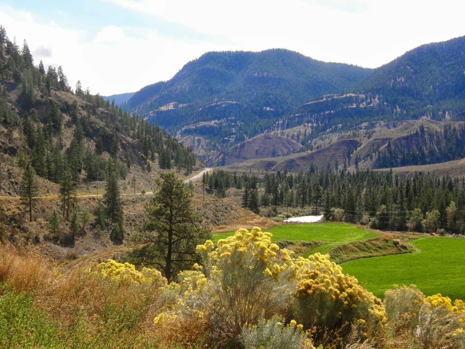
south on the Seward Highway until we reach the Sterling Highway then turned west toward Soldotna. Shortly after turning we entered Coopers Landing, this was about 12:30 Cassie decided we should stop for bathroom and a lite lunch. We saw a place called Sunrise Cafe, a gas station, café and night club all rolled into one building. It did not look like much, night club wasn’t open so we entered the café. Cassie used the bathroom while I looked over the menu. She return and said the bathroom was nice the toilet actually flushed. She has been in the back country too long. The food was good, the people friendly, and a very nice place. We are glad we stopped. We arrived at the hotel about 2:30, unloaded what we needed and rested a while. About 4 we decided to drive around City of Kenia and Soldotna. Both of these towns are primarily built for fishing. I was surprised that each town has a McDonalds and other fast food places, we normally only saw theses in and around Anchorage or Fairbanks. Unless you wanted to fish nothing really made an impression on me. We ended the day getting some McDonalds and eating in our room. I did not stay up late and did get a good night sleep.

On Monday we planned to drive down to Homer and see what we could. The motel owned a restaurant next door. Instead of providing breakfast they gave us each a 15 dollar voucher for breakfast next door. On Monday morning we had to pay an extra 1.72, breakfast is not cheap. We ate about 10 and left for Homer about 2 hours away. We stopped a few times for pictures. We went thru Anchor Point on our way to Homer. You say, Anchor Point is important because, well it is North America’s Highway System most western community. There are other communities further west but the highway system will not get you there. On to Homer which is on the Cook Inlet and primarily built for fishing activities. Halibut is the main large fish in this area. We drove to the end of Homer Spit, a long, narrow land mass extending into Cook Inlet. It has many boats docks as well as many shacks for food and gifts. We saw a lot of cars parked but not many people, I assume they were all out on fishing or tour boats. Homer is served by the Alaska Marine Highway (ferry) System. If you want to go to the Kodiak Islands you go through Homer. I got the impression Homer is a busy place in late June, July and early August. But I did not see much I would return to see. We returned to Soldotna around 3 and stopped at a Deli where we each had a build your own sandwich. They were good, of course they were, we built them. We rested the rest of the day, I did not want to do too much, you know still recovering or just being lazy.

We ate from our snack box for supper since we had a very late lunch.

One other note about Sept. 9. 38 years ago today I started in my chosen profession (computers), at the only company at the time that would hire me. Some 35 years later I retired after a very fulfilling career which entailed involvement in all aspects of the business at all levels. That involvement, especially over the last 10 years, allowed us to take this and other trips over the past several years. I am extremely appreciative to all I worked with and for, they allowed me to reach my goals. Sept 9 will always be a special day for me.

This ended day 32. Tomorrow on to Seward.
On this trip we have seen all type of
transportation I saw 20 people enter this vehicle.
Lighthouse on way to Homer

Cassie on beach at Lighthouse

The sign says it all

Homer Spit

Shacks on Homer Spit